
History of Arrochar, Argyll and Bute in photos
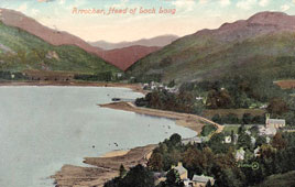
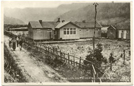
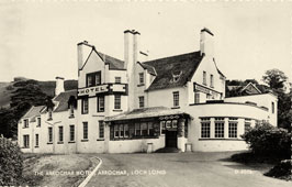
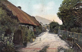
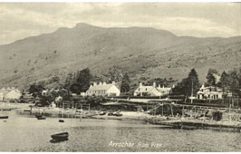
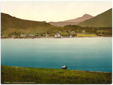
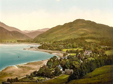
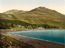
History“Arrochar” is thought to derive from the Gaelic “Ard tir”, meaning the high land, or the land on the East. Another hypothesis is that it derives from the Gaelic “arachor”, which was the name for an old Scottish measurement for an area of land measuring 104 acres. Arrochar was the original home of the Clan MacFarlane, who owned the local land from 1225, and who were well known for being cattle thieves. The moon, whose light allowed the men to pursue their spoils, became known as “MacFarlane’s Lantern”, and is often still referred to as such by locals. In 1263 there was a Viking incursion in this area under the command of King Hakon. He is said to have sent 60 ships up Loch Long, his men landing at Arrochar. They are thereafter said to have dragged their boats over the two miles between Loch Long and Loch Lomond using wooden rollers. Re-launching their boats in Loch Lomond, they launched an assault on the local inhabitants. It is suspected that a battle took place between the Vikings and the early MacFarlanes, and there is a burial ground midway between Arrochar and Tarbet which to external appearances may be the grave of a Viking leader. As late as 1787, only MacFarlanes were allowed to reside on their lands. The MacFarlane’s first known castle was on the Island of Inveruglas, on the Western side of Loch Lomond. The island, being close to the Western shore, came under the fire of Cromwell‘s cannons and suffered partial damage. The seat of the clan moved around the local lands, always keeping within the vicinity of Arrochar. The first church in Arrochar was built in 1733, and was presented with two silver cups for Holy Communion in 1742, both of which survive to this day. A school appears to have been built prior to 1767, and in 1791 the population stood at 379. Land ownership came to be divided among a greater number of individuals. It was in the early 1800s that Arrochar became a popular tourist destination, as steamers made their way up the Clyde Estuary from Glasgow. More people came to the area towards the end of the 19th Century with the construction of the West Highland Railway Line. A sea wall was built in 1926, and the Royal Navy Torpedo Range was, having been built in 1912, now increasing in productivity, which peaked during the Second World War. More people came to the area in the late 1940s and early 1950s as Loch Sloy Hydroelectric Dam was being built. This led to the construction of more housing in Succoth, a small village beside Arrochar. Unfortunately, Glencroe School closed in 1984, followed by the closure of the Torpedo Range in 1986. Arrochar is now reliant on tourism and forestry, and is an excellent base for exploring the hills and mountains of the area, to have a fishing or outdoors trip, or simply to have a relaxing break away from the city. | ||||||||||||
Photos posted on the website in accordance with Article 7, paragraph 1 of the Berne Convention for the Protection of Literary and Artistic Works of 9 September 1886, the term of protection which is fifty years after the author's death.
After this period photos it becomes public domain. The participants of the Berne Convention are 167 States.